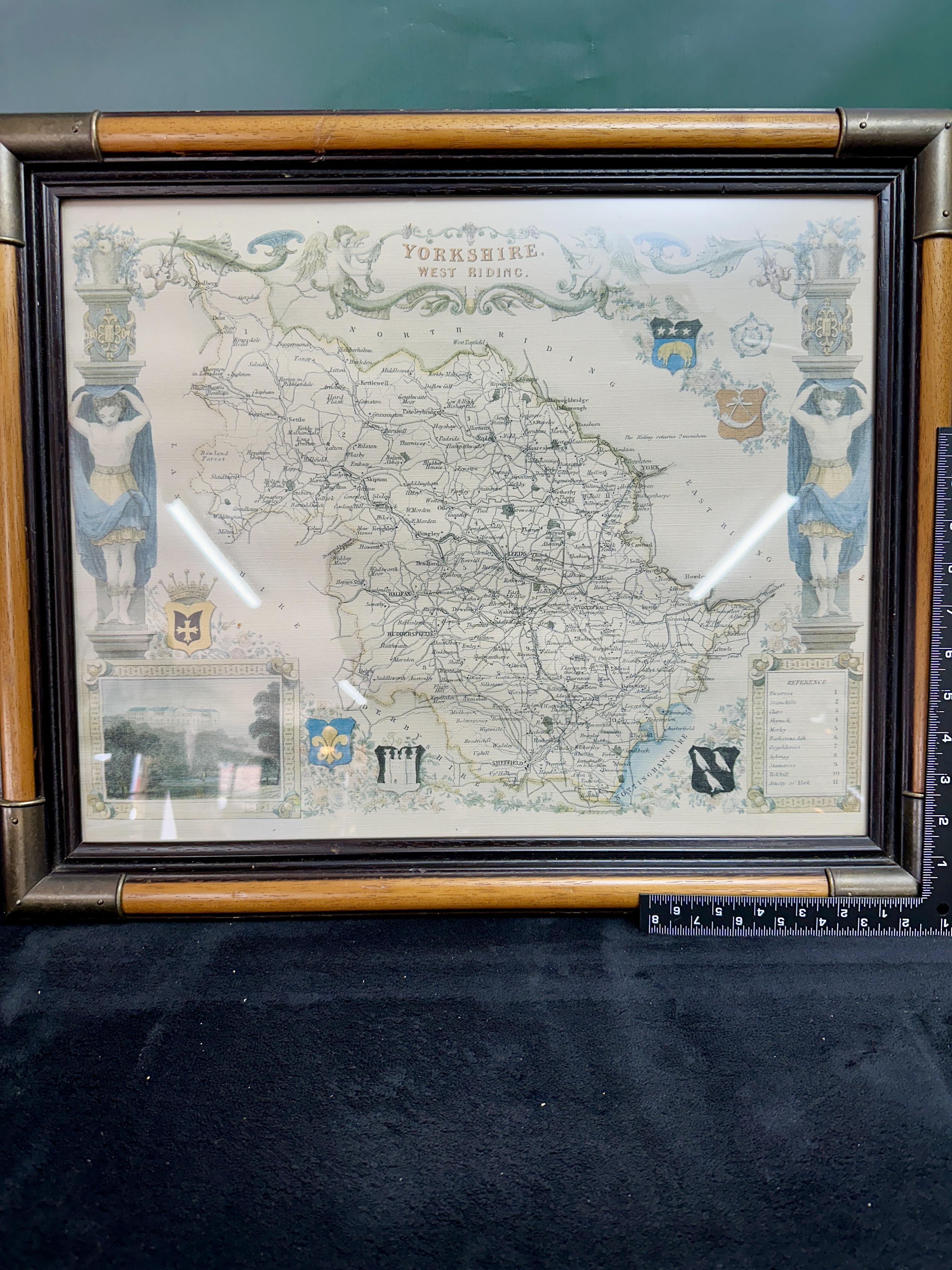
A mid-19th-century hand-coloured engraved map of Yorkshire, West Riding, by the cartographer Thomas Moule (1784–1851). The map is characteristic of Moule’s highly decorative style, featuring an ornate border with classical and symbolic elements. The title is centered at the top within a scrolled banner supported by putti. The map is flanked by two large architectural columns supported by classical male figures, or atlantes, draped in blue and gold cloth. The composition is further embellished with several coats of arms representing regional towns and families. The bottom left corner contains a fine engraved vignette identified as Harewood House. A numerical reference table (1–11) is located at the bottom right, identifying the regional Wapentakes including Ewcross, Staincliffe, Claro, Skyrack, Morley, Barkston Ash, Osgoldcross, Agbrigg, Staincross, Strafforth and Tickhill, and the Ainsty of York. The cartography provides a detailed view of the region’s topography, including towns such as Leeds, Sheffield, and Huddersfield, as well as villages and major roadways of the early Victorian period. The map is presented behind glass in a late 19th-century stained wood frame with a bamboo-style turned profile, decorated with stamped brass-tone metal corner brackets and central accents.
Frame width: 20 inches (approx. 51 cm)
Frame height: 16 inches (approx. 40.5 cm).
Condition report:
The map exhibits light, even toning to the paper consistent with age. The hand-colouring remains bright and well-defined. No significant visible tears or foxing are present, though minor age-related discoloration is noted. The frame shows minor surface scuffs and wear commensurate with age.
Share this lot: